Creating the "Satellites" infographic
Here we'll take a quick look at the process behind creating this graphic. It includes collecting and sorting the data, sketching the visualization ideas and figuring out the ways of plotting the information.
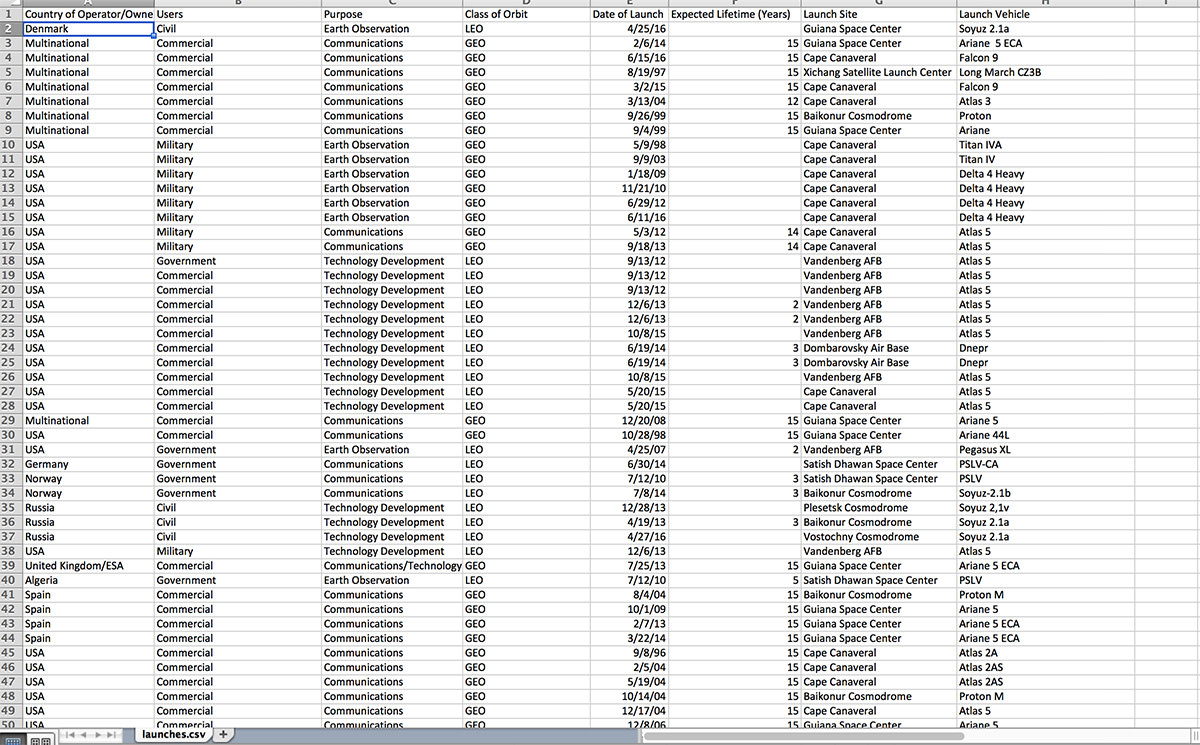
Let's start with data. There's plenty of resources where we can find open source data on this particular topic. Let's use this wonderful resource from Kaggle – Active Satellites Orbiting Earth, produced and updated by Teri Grimwood.

Database file in its full glory
That's about 1400 rows of descriptions (which is very manageable, compared to usual HUGE database files)
Let's start by sorting and filtering out the information we'll need for our graphic.
We'd like to see the following:
1. Which countries have the most satellites?
2. What are those satellites mostly used for?
The data sorted and filtered
Here's the sketch of the direction we'll be going for:
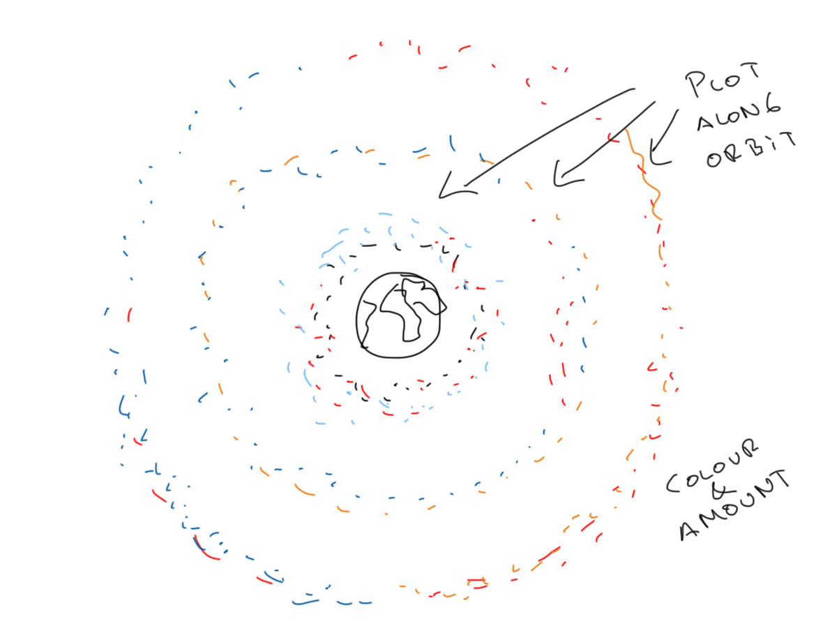
Now that we know the amount of satellites, types and their uses, I'd like to plot them along their orbits, and colour code those bad boys/girls.
We don't necessarily want to display and call out numbers, but create a visual sense on the total amount and use of the satellites - we'll represent the orbiters as "dots" and plot them along their orbits. The density will show the amount and uses of satellites.
Here's out first problem:
It would be fairly easy to visualize this if I knew enough about code and scripts, but without this knowledge, how to we plot large amounts of "dots" to show a pattern, and still be fairly accurate?
Let's jump into illustrator.
Here we have a few options: We could create some dots, and using Symbols, sprinkle them around, but that won't be accurate. We could create everything manually, but that would take too long.
Solution: We'll be using the amazing Illustrator plugin by Astute Graphics - ColliderScribe v2. The Space Fill feature in particular.
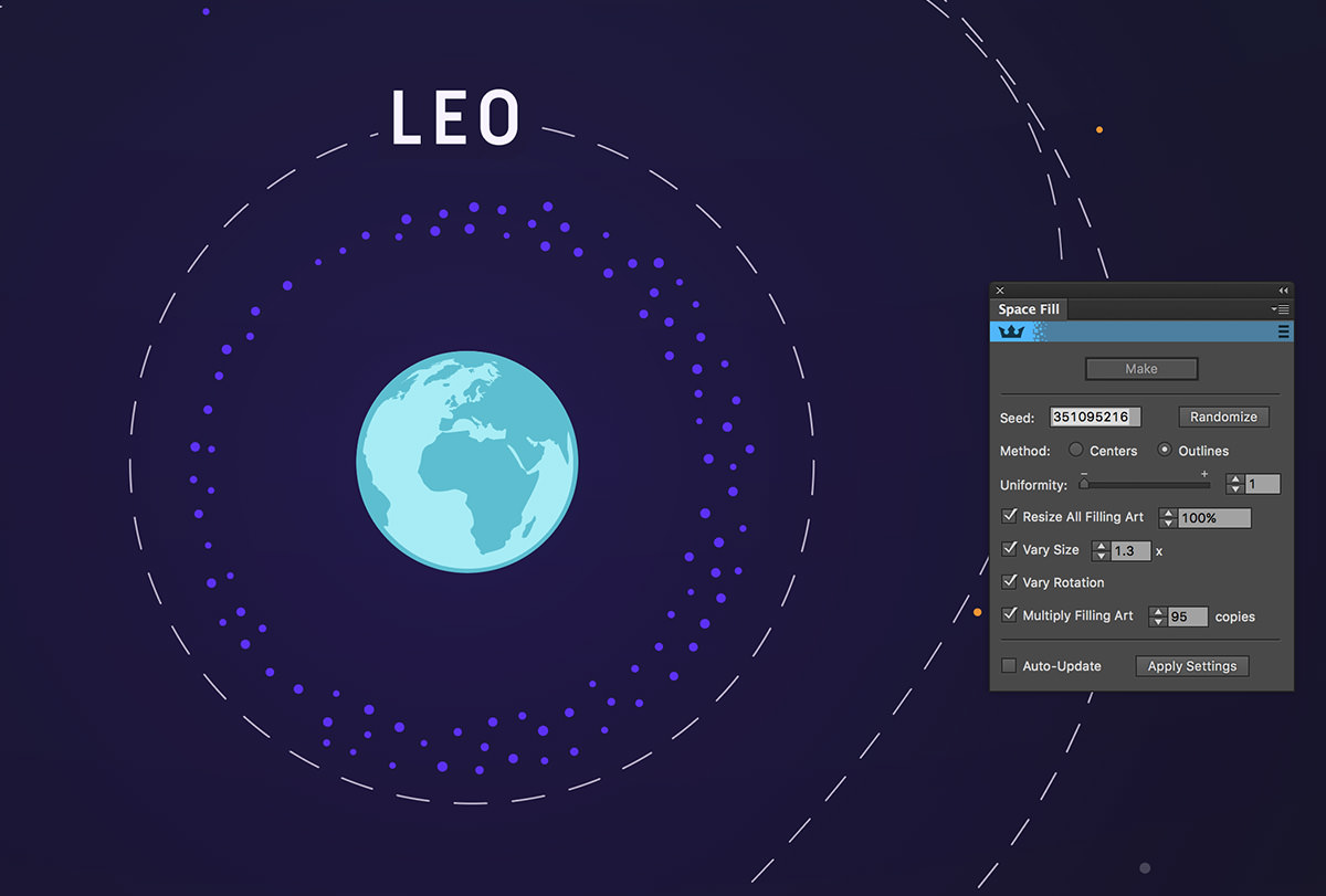
95 satellites in Lower Earth Orbit are used for Civil purposes

156 satellites in Lower Earth Orbit are used by Military

235 satellites are Commercial
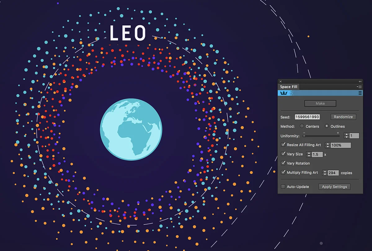
294 are used for various Government business
The result is the representation true to the numbers, easily editable, and we can effortlessly manipulate the vector shapes to create better visualizations!